Who We Are

We sold our home in June, 2007, and spent the next 7 1/2 years traveling full time in a Cross Roads Fifth Wheel. (We had been traveling during our summers for several years before going full time.) We loved the full-time lifestyle! Each summer we spent a month or two volunteering in State Parks, first in Indiana at McCormick's Creek State Park, near our family, then in later years as the grandchildren got older, at the Bluewater Lake State Park in New Mexico. We spent 6 months each winter at Cactus Gardens RV Resort in Yuma, AZ, where I worked mornings in the park office. The remaining months were spent on the road, seeing this great country of ours. Our favorite places are our National Parks. Anita loved photography and the freedom of digital photography, taking sometimes hundreds of photos in a day. We hiked as much as our legs will allow. We also really enjoyed square and round dancing as we travel across country, and meeting all the wonderful people who dance and/or travel.

But as in all things, there comes a time for change, and we decided it was time to create roots once more. In the fall of 2014, we purchased a home in Cactus Gardens, and in the spring of 2015, sold the 5th wheel. Anita also retired in the spring. We will continue to travel each summer, but for a shorter period of time. We hope to continue blogging about those trips, but it will obviously be on a more limited basis than in the past.

Please explore our past posts if you are interested in traveling this great country. You'll find an index in the left column. We hope you enjoy our blog, and appreciate all comments
Showing posts with label Arizona. Show all posts

Saturday, September 25, 2010

The Hopi Celebration

The Hopi Indians are an integral part of Flagstaff.  Recently, a large building bordering downtown’s Heritage Square was renamed “the Hopi Building”; 2010-09-25 - AZ, Flagstaff - Hopi Celebration - 1005

the tribe held a celebration around the ribbon cutting. 2010-09-25 - AZ, Flagstaff - Hopi Celebration - 1007

Cake and punch was provided for the crowd, an arts and crafts fair provided a look at their work, and dancers entertained.

Each tribe has a different way of expressing themselves through art.  For the Hopi, it’s stylized paintings and weaving.  We enjoyed looking at the colorful offerings.2010-09-25 - AZ, Flagstaff - Hopi Celebration - 1012

2010-09-25 - AZ, Flagstaff - Hopi Celebration - 1017  2010-09-25 - AZ, Flagstaff - Hopi Celebration - 1014

This young man demonstrated a traditional spinning toy for us.2010-09-25 - AZ, Flagstaff - Hopi Celebration - 1016 Four teenagers provided the dancing entertainment.  We’ve seen several tribes performing in dance exhibits; the one thing that stood out in the Hopi dancing was that they enter the arena backwards.

2010-09-25 - AZ, Flagstaff - Hopi Celebration - 1019 2010-09-25 - AZ, Flagstaff - Hopi Celebration - 1021 2010-09-25 - AZ, Flagstaff - Hopi Celebration - 1024 2010-09-25 - AZ, Flagstaff - Hopi Celebration - 1026 2010-09-25 - AZ, Flagstaff - Hopi Celebration - 1028

It’s good to see the youth working to preserve their heritage.

Thursday, September 23, 2010

Sedona, Arizona

Flagstaff to Sedona Overall, Sedona was a bit of a disappointment to us.  There are times when you build up an image in your mind that a location cannot live up to; Sedona was such a place.

Instead of the romantic, red rock vista we envisioned, your first view of Sedona is a bustling, tourist trap.  But, let’s back up and start with the trip down. 

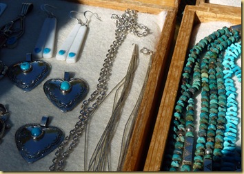
We chose Scenic Route SR89-A, and it was definitely scenic.   Just before starting the descent through the canyon, the rest stop, Oak Creek Canyon Vista, offers panoramic views of the valley, and a chance to shop with the many Native American vendors who set up in the open air market along the path.  Most were selling jewelry or pottery.2010-09-23 - AZ, Flagstaff to Sedona via 89-A thru Oak Creek Canyon  (14) 2010-09-23 - AZ, Flagstaff to Sedona via 89-A thru Oak Creek Canyon  (15)

Winding down through Oak Creek Canyon, the road descends more than 2500 feet rather rapidly.  2010-09-23 - AZ, Flagstaff to Sedona via 89-A thru Oak Creek Canyon  (8)

If you look closely in the following photo, you can see 3 different sections of the road’s switchbacks down the mountain.

2010-09-23 - AZ, Flagstaff to Sedona via 89-A thru Oak Creek Canyon  (12)b

2010-09-23 - AZ, Flagstaff to Sedona via 89-A thru Oak Creek Canyon  (26)

2010-09-23 - AZ, Flagstaff to Sedona via 89-A thru Oak Creek Canyon  (28) 

At the end of the canyon drive, the Midgley Bridge carries you into Sedona.

2010-09-23 - AZ, Flagstaff to Sedona via 89-A thru Oak Creek Canyon  (31)

Just driving through Sedona offers many examples of interesting architecture,    2010-09-23 - AZ, Sedona -3- Red Rock Loop Scenic Drive - 1003

2010-09-23 - AZ, Sedona -3- Red Rock Loop Scenic Drive - 1005but probably the two most unique are situated next to each other.

The first, one of the most popular tourist stops, is the Chapel of the Holy Cross.2010-09-23 - AZ, Sedona -2 - Chapel of the Holy Cross - 1003  Conceived by Marguerite Bruswig Staude in 1932, it was finished in 1956.  The design inspiration came to her while observing the newly constructed Empire State Building.  When viewed from a certain angle, a cross seemed to impose itself through the very core of the structure.  Mrs. Staude wanted to build such a structure that would glorify her Creator and in thanksgiving for all that her family had received. She traveled throughout Europe looking for the ideal location. She returned to the United States and while her and her husband  traveled through Sedona, she was struck by the beauty of the area and decided that this chapel should be built here. .. “This would be a monument to faith…".

2010-09-23 - AZ, Sedona -2 - Chapel of the Holy Cross - 1011

Built on a twin pinnacled spur about 250 feet high, jutting out of a thousand foot red rock wall, "solid as the Rock of Peter" the building of the Chapel was completed in April 1956.2010-09-23 - AZ, Sedona -2 - Chapel of the Holy Cross - 1002 Just the physical construction was a physical miracle, overcoming difficult conditions to construct this chapel.2010-09-23 - AZ, Sedona -2 - Chapel of the Holy Cross - 1012

No longer used for regular services, it is open daily to the public.

Visible from the chapel, at the bottom of the hill is what some consider an eyesore, while others marvel.  A veritable mansion sits on grounds surrounded by beautiful gardens.  Owned by some “mystery person involved in the medical field” it was once offered for sale for 29 million.2010-09-23 - AZ, Sedona -2 - Chapel of the Holy Cross - 1005

2010-09-23 - AZ, Sedona -2 - Chapel of the Holy Cross - 1007

2010-09-23 - AZ, Sedona -2 - Chapel of the Holy Cross - 1008

The Red Rock Loop Drive is through the famous red rocks of Sedona, 2010-09-23 - AZ, Sedona -3- Red Rock Loop Scenic Drive - 1009

but better views can be found at the overlook near the airport.2010-09-23 - AZ, Sedona -4- Airport Overlook - 1004  2010-09-23 - AZ, Sedona -4- Airport Overlook - 1006

2010-09-23 - AZ, Sedona -4- Airport Overlook - 1007

Although we weren’t impressed with the shopping district, I did enjoy the many statues adorning the sidewalks.  2010-09-23 - AZ, Flagstaff to Sedona via 89-A thru Oak Creek Canyon  (34)

This one is unique.  The little girl taking the photo is part of the statue. 2010-09-23 - AZ, Flagstaff to Sedona via 89-A thru Oak Creek Canyon  (35)

But nothing thus far had fit the image I had of Sedona in my mind.  In years past, we used to work a lot of jigsaw puzzles.  So many of the puzzles pictured beautiful garden fountains surrounded by Spanish tile and flowering bushes.  Always, the caption was just “Sedona, Arizona”.  Where had these photos been taken?  I finally had my answer when we entered Tlaquepaque (pronounced Tla-keh-pah-keh), Sedona's Arts & Crafts Village.

Authentically fashioned after a traditional Mexican village, Tlaquepaque, means the "best of everything".  Its vine covered stucco walls, cobble-stoned walkways and magnificent arched entryways makes it seem a world and time away from the rest of Sedona, and provides a refreshing oasis from the crowds.  Here I found the Sedona I had been looking for: 2010-09-23 - AZ, Sedona -1- Tlaquepaque - 1001 2010-09-23 - AZ, Sedona -1- Tlaquepaque - 10032010-09-23 - AZ, Sedona -1- Tlaquepaque - 10062010-09-23 - AZ, Sedona -1- Tlaquepaque - 1010  2010-09-23 - AZ, Sedona -1- Tlaquepaque - 1007 2010-09-23 - AZ, Sedona -1- Tlaquepaque - 1008  2010-09-23 - AZ, Sedona -1- Tlaquepaque - 1013 2010-09-23 - AZ, Sedona -1- Tlaquepaque - 1015


Wednesday, September 22, 2010

Wupatki National Monument

Wupatki By the late 1100s, thousand of Pueblo people were farming on the land now known as Wupatki (Woo-POT-Key. or in Hopi, Big House).  It’s quiet now, but standing among the ruins, you can almost hear the echoes of those long ago voices. 

Unlike nearby ruin sites with only one major structure each, Wupatki contains more than 800 identified ruins, testament to just how many inhabitants were once here.  Only 5 of the largest ruins are open to the public.

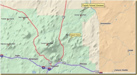
The park, just north of Flagstaff, is essentially a “drive-thru” park , with the road connecting at the southern end with Sunset Crater National Monument.

2010-09-22 - AZ, Wupatki -Sunset Crater National Monuments - 1016 First stop of the drive is near the Box Canyon dwellings and Lomaki Pueblo.  A short trail leads to the ruins.  The Lomaki  dwelling is built right on the edge of a shallow, vertical-walled canyon, with the San Francisco Peaks looming in the west.  The uniform slabs of red sandstone, arranged in an orderly stack, reinforced with clay-based mortar, resulted in extremely well built pueblos.

The one statement that impressed me most this day is from one of the interpretive signs at this site:

2010-09-22 - AZ, Wupatki -Sunset Crater National Monuments - 1069”The inhabitants of the pueblo also placed numerous pottery jars at the base of overhangs to catch rainwater.  When the rain did not come they had to walk 10 miles to the Little Colorado River drainage to fill their pottery jars.”

I gazed out at the stark, dry desert landscape, and could not imagine what it would be to live here all my life, with the nearest reliable water source 10 miles away.2010-09-22 - AZ, Wupatki -Sunset Crater National Monuments - 1015

Box Canyon Dwelling

Nalakihu is a partly restored pueblo. There are indications that it was started as one room, and gradually enlarged overtime.2010-09-22 - AZ, Wupatki -Sunset Crater National Monuments - 10422010-09-22 - AZ, Wupatki -Sunset Crater National Monuments - 1041
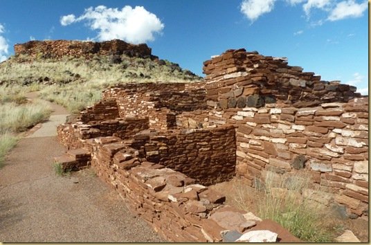
A short trail leads upward to the Citadel Pueblo, sprawling across the top of a small hill. 2010-09-22 - AZ, Wupatki -Sunset Crater National Monuments - 1044 The few remaining walls, the outsides jutting straight up at the edge of the hill are evidence of the building skills involved.  2010-09-22 - AZ, Wupatki -Sunset Crater National Monuments - 1053We found it interesting that in this structure’s walls, the volcanic rock seemed to have been combined decoratively with the sandstone slabs. 2010-09-22 - AZ, Wupatki -Sunset Crater National Monuments - 1055
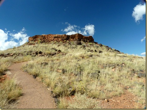
The pueblos were part of a large community.  At least eight other sites can be seen from this hill.

The most impressive ruin is Wupatki, situated behind the Visitor Center.

This three story structure contained over 100 rooms, and was home to as many as 300 people.2010-09-22 - AZ, Wupatki -Sunset Crater National Monuments - 1080The structure has been partially reconstructed.  At one time, a couple of rooms was even home to the first park manager and his wife, and such modern conveniences as a gas range was installed!  Evidence of their occupation has long since been removed.2010-09-22 - AZ, Wupatki -Sunset Crater National Monuments - 10892010-09-22 - AZ, Wupatki -Sunset Crater National Monuments - 1102As was common among pueblos of that time,   an open arena “community room” was constructed in front.
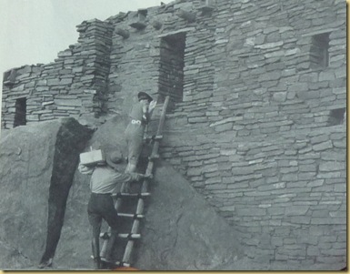
2010-09-22 - AZ, Wupatki -Sunset Crater National Monuments - 1076

Unusual here, however, are ruins identified as a ball court, similar to the courts found in Meso-America and in the Hohokam ruins of southern Arizona. This is the northernmost example of this kind of structure.2010-09-22 - AZ, Wupatki -Sunset Crater National Monuments - 1075

Here’s a closer look at some of the many rooms.

Many of the rooms appear to have been constructed with a large rock as part of the wall.2010-09-22 - AZ, Wupatki -Sunset Crater National Monuments - 1091

This room has been identified as a “burial room”.  Note the stoned up door and window.  Did that mean no more would be buried here?  Does it denote a spiritual belief?2010-09-22 - AZ, Wupatki -Sunset Crater National Monuments - 1096

How would you like this conversation piece as part of  your wall?2010-09-22 - AZ, Wupatki -Sunset Crater National Monuments - 1098

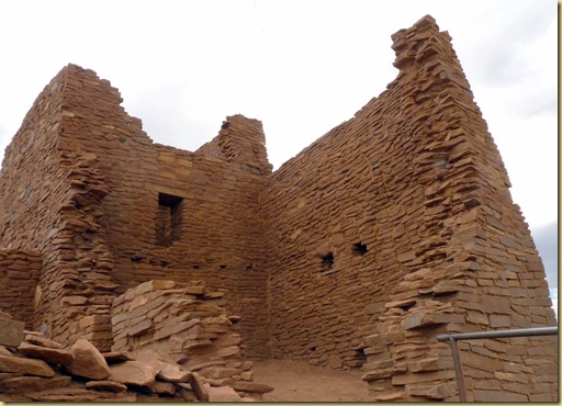
About two miles off the main road lies the Wukoki Pueblo, another distinctive ruin, as the house is built on an isolated block of sandstone, visible for several miles across the flat surroundings. 2010-09-22 - AZ, Wupatki -Sunset Crater National Monuments - 1134 The structure is quite tall, centered on a square, three story tower with a series of intricately constructed rooms at one side. The bricks have a deep red color, and the
building merges seamlessly with the underlying rock.
2010-09-22 - AZ, Wupatki -Sunset Crater National Monuments - 1119 2010-09-22 - AZ, Wupatki -Sunset Crater National Monuments - 1121

The park road connects the Wupatki National Monument with Sunset Crater Monument, which seems fitting, considering how the Wupatki community was affected by the volcano. 

Did the people have warnings of tremors before the ground begin to emerge in a swiftly growing hill, and then exploded and showered cinders upon them, or did it occur without warning?  Did they see the flowing lava as doomsday, as a punishment of sorts?  Sunset Crater One of the displays in the Sunset Crater Visitor Center explores the legends of three tribes:

The Hopi tell “of the ground having ‘boiled’ and come up.  Strong winds came, and the lightning swirled around the peaks.  More than one explosion occurred.  Sunset Crater is a living reminder that something exists below.  If we stray from our religious ideals and lifeway, there may be another eruption.”

Navajo legend relates “Long ago, there was a pond on top of Sunset Crater where buffalo drank water.  As time went on, there was a dispute between the buffalo and the Sun.  The Sun got angry and blew up the crater with boiling hot fire.  The land was smaller then, and it grew larger and changed.”  Today, Sunset Crater is one of the offering places used by the Navajo Medicine People.

Zuni members are a little more guarded with their stories of the event for fear of creating another catastrophe.  This belief is if people continually dwell upon negative events those events will happen.Sunset Crater area

Regardless of tribal explanation, the eruption at sometime between 1040 and 1100 changed life in the area.  Many of the farmers were forced to abandon their lands, but by 1180, new farmers had discovered the area to be even better for farming, as the layer of ash enriched the land, and aided in water retention.  Why then, by 1250, were all the pueblos abandoned? It’s a mystery that no one will ever solve.

Sites such as Wupatki hold a fascination for us, a glimpse into the far past.  They cause us to stop and think what life then would have held for us.

Primitive culture? By our standards, definitely.  Yet there were organized recreational activities (ball games), 2010-09-22 - AZ, Wupatki -Sunset Crater National Monuments - 1068

outstanding pottery creations, 2010-09-22 - AZ, Wupatki -Sunset Crater National Monuments - 1071

and I was especially intrigued by a tiny piece of finely woven open-work cotton cloth, almost lacy in appearance. 

2010-09-22 - AZ, Wupatki -Sunset Crater National Monuments - 1071

.

.

.

.

.

Primitive?  800 years from now, how primitive will our present culture seem? It’s all relative, isn’t it?


Panguitch to Flagstaff