Who We Are

We sold our home in June, 2007, and spent the next 7 1/2 years traveling full time in a Cross Roads Fifth Wheel. (We had been traveling during our summers for several years before going full time.) We loved the full-time lifestyle! Each summer we spent a month or two volunteering in State Parks, first in Indiana at McCormick's Creek State Park, near our family, then in later years as the grandchildren got older, at the Bluewater Lake State Park in New Mexico. We spent 6 months each winter at Cactus Gardens RV Resort in Yuma, AZ, where I worked mornings in the park office. The remaining months were spent on the road, seeing this great country of ours. Our favorite places are our National Parks. Anita loved photography and the freedom of digital photography, taking sometimes hundreds of photos in a day. We hiked as much as our legs will allow. We also really enjoyed square and round dancing as we travel across country, and meeting all the wonderful people who dance and/or travel.

But as in all things, there comes a time for change, and we decided it was time to create roots once more. In the fall of 2014, we purchased a home in Cactus Gardens, and in the spring of 2015, sold the 5th wheel. Anita also retired in the spring. We will continue to travel each summer, but for a shorter period of time. We hope to continue blogging about those trips, but it will obviously be on a more limited basis than in the past.

Please explore our past posts if you are interested in traveling this great country. You'll find an index in the left column. We hope you enjoy our blog, and appreciate all comments
Showing posts with label Moab. Show all posts

Monday, September 13, 2010

La Sal Mountain Loop Drive

No matter which road you take from Moab, it is a scenic drive.  We decided to drive today through the nearby La Sal Mountains.    P1100724

The second-highest mountain range in Utah, the La Sals have a dozen peaks that soar over 12,000 feet.  The name means “Salt Mountains” and came from the unusually salty springs around the base of the mountains.   The range fills the southeastern horizon at our RV park here in Moab.  (OK RV Park).   

Driving the narrow mountain road of 65 miles or so exposes one to mountains, canyons, buttes,  stretching desert floors, red rock cliffs, groves of quaking aspen,stands of ponderosa pine, and long, cool stretches of spruce and fir forests.

Two scenes stand out in our mind about the drive.  The first is the oft photographed Castle Valley.P1100685Castle Valley was probably first used as a movie setting in 1949, when John Ford shot Wagon Master, starring Ben Johnson and Harry Carey, Jr.  The valley, Arches National Park and the Moab area in general soon became a popular movie site.  Last year, while here, we visited the Movie Museum at Red Cliff Lodge.

A famous Chevrolet commercial was also shot here for the 1964 Chevy.  (The video is mistakenly labeled Monument Valley, another favorite site for westerns, south of Moab.

The second scene that stands out in our minds will be the bear crossing the road in front of us.  Unfortunately, I was not quick enough on the shutter to capture that scene.

Want to go for a drive with us?  The drive begins in Moab, follows the Colorado River Canyon east for a few miles, then heads through the mountains.  Click on the cartoon below:

La Sal Slide show 

Sunday, September 27, 2009

Road Trip from Moab, UT to Torrey, UT

At the end of our week in Moab, we headed west to the tiny village of Torrey, UT.  As we followed first I-70, and then SR 24, our comments were on the order of “Ahhh…”, “Look over there!” , “Did you see that?” as one picture postcard view followed another along the whole route. 

Before reaching Torrey, we passed the boundary line for Capitol Reef National Park, and the remainder of the drive was within the park boundaries.

Come, take the drive with us as we follow Hoyt and Bernice down the road to Torrey, UT.

ca

ca

Saturday, September 26, 2009

Canyonlands National Park – Our Week in Moab, Part 6

Canyonlands is the largest national park in Utah.  There are three major divisions of the park.  We visited the Island in the Sky, which sits atop a massive 1500 foot mesa, living up to its name quite literally.  ca

20 miles of paved roads lead to many of the most spectacular views in Utah.  From the viewpoints, you can see nearly 100 miles on a clear day.ca

We hiked several trails throughout the day, the first being out to the end of the ‘island’ to Grand View Point, the second to Upheaval Dome and the third to Mesa Arch.

For a slideshow of our day: ca

Friday, September 25, 2009

Movie Museum at Red Cliffs Lodge – Our Week in Moab, Part 5

Since the earliest western movies, many of our favorites have been filmed in the Moab area.  So many, in fact, that a Museum of Film and Western History was established in the Red Cliffs Lodge just north of Moab.

We could not finish our week in Moab without a look, so a short, but scenic road trip was in order.  The scenery surrounding Moab is spectacular in all directions, and once again, we were not disappointed.  The trip was definitely just as enjoyable as the destination.mm1 Here’s the link for more pictures:

mm2

Thursday, September 24, 2009

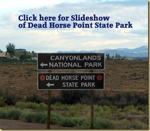
Dead Horse Point State Park – Our Week in Moab, Part 4

dh1 Around the turn of the century, the narrow point, high above the steep walls of a canyon,was used as a corral for wild mustangs roaming the mesa top.  Cowboys rounded up these horses, herded them across the narrow neck of land and onto the point. The neck, which is only 30 yards wide, was then fenced off with branches and brush. This created a natural corral surrounded by precipitous cliffs, affording no escape. Cowboys then chose the horses they wanted and let the culls or broomtails go free. One time, for some unknown reason, horses were left corralled on the waterless point where they died of thirst within view of the Colorado River, 2,000 feet below.  And so goes the legend behind the name of Dead Horse Point State Park near Moab.

Dead Horse Point is a small state park covering just a few square miles of land, but the  spectacular view rivals that of the Grand Canyon.

dh2 Towering 2,000 feet above the Colorado River, the main overlook of Dead Horse Point State Park has a 270° vista over the Colorado and its side canyons, from the bright turquoise tailing ponds of a potash mining complex in the northeast, along the river and south across vast areas of eroded ridges, buttes, pinnacles and cliffs with the La Sal Mountains in the far distance, then west to the near side of the Island in the Sky mesa and northwest along several branches of Shafer Canyon.

dh3 Plenty of the river and its corridor of greenery is visible, 1,900 feet below, including one big gooseneck meander close to the viewpoint.

 dh4 A dirt track winds over the rocky desert at the base of the cliffs - this is Potash Road, which follows the Colorado river starting just north of Moab. It is paved at first, as far as the potash mining complex, then unpaved for the next 17 miles, ending with a steep ascent up the cliffs at the head of Shafer Canyon where it joins the national park drive.

Join us on our hike.

dh

Wednesday, September 23, 2009

The Fiery Furnace of Arches – Our week in Moab, part 3

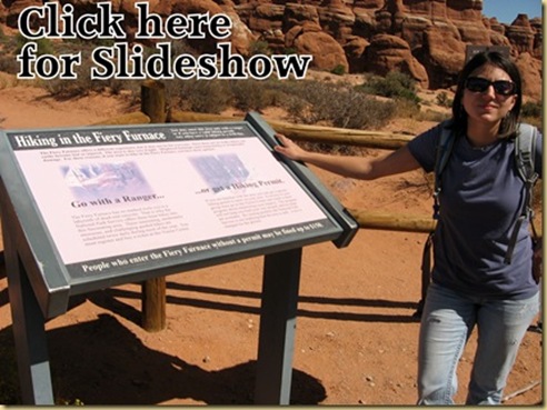
ff1 Perhaps one of the most strenuous hikes in Arches National Park is the one through the Fiery Furnace, so called from the vivid color of the stones in late day.  The Furnace is a labyrinth of narrow sandstone canyons and fins, created over the years by erosion.  The route requires scrambling and squeezing through tight spaces.  This relatively small area is one of the most incredible and spectacular places in the park.This hike can only be taken with a guide, or a special permit, as it is very easy to lose your orientation among the rocks and get lost, or to fall and get injured, or both.

ff2 We chose to take the morning hike, to avoid the heat of the day.   Over two dozen people  gathered early in the morning at the entrance to the area.

We spent the next three hours, walking and climbing on irregular and broken sandstone, along narrow ledges above drop-offs and in loose, sometimes wet, sand. There are cracks which must be stepped over and narrow places in the rock that you must squeeze into and pull yourself up and through. In some of these places, you must hold yourself off the ground by pushing against the sandstone walls with your hands and feet.

There is no trail, and due to the maze-like nature of the terrain, one is committed to completing the hike once they have entered the Fiery Furnace.  It was one of the most enjoyable hikes we’ve made.

As always, pictures speak much more eloquently than words.  Have a look at our hike:ff

Tuesday, September 22, 2009

In Search of Petroglyphs – Our week in Moab, Part 2

p1 Petroglyphs are images created by removing part of a rock surface by incising, pecking, carving and abrading, usually by prehistoric people.  In the Desert Southwest, most petroglyphs have been created on rocks bearing desert varnish.

Desert varnish is created in areas of low precipitation, and is formed from just the right combination of clay, wind, high temperatures and dew.  It is a thin surface layer of black or navy coloring, which in appearance resembles the old chalkboards, and provided an excellent place to carve, exposing the lighter rock underneath.

We visited three petroglyphs sites near Moab.  The first, Moon Flower Canyon, is behind a protective fence, but that has not prevented the panel of 100 feet by 12 feet high from being highly vandalized over the years.  Why is it that folks visiting these sites cannot appreciate the history behind the etchings, a record that once destroyed, can never be regained? 

p2 The panel contains many figures, including a large human shape with headdress, bighorn sheep and a number of abstract elements.  The site is located on the south bank of the Colorado River at the entrance of a lovely canyon named for the datura (or Moonflowers) growing there.  Pictures from Moon Flower Canyon are in the slideshow (link below)

On the north side of the River, we found another site.  Historians believe these petroglyphs were created between 600 and 1300 A.D.  These carvings include animals, lines of hand-holding men and triangular figures with spears and shields.  It is very hard to photograph these sites due to the reflective quality of the desert varnish.

Another interesting bit of history found on this road is the dinosaur tracks.  We found several sites around Moab with similar tracks documented.  The tracks on this road were up on the side of a hill, and best viewed through binoculars or the zoom lens of a camera. p3

p4 The third petroglyph panel we found runs from ground level up about 30 feet and is about 90 feet wide.  This site caused us a few smiles, especially when we found a figure that very closely resembled Santa and his sled.  Santa has really gotten around over the ages, hasn’t he?

p5


Friday, September 18, 2009

Arches National Park – Our Week in Moab, UT Part 1

ar1 Arches National Park is a masterpiece of erosion, and we were spellbound by it’s splendor throughout our visit. 

An arch is a natural formation where a rock arch forms, with a natural passageway through underneath.  The opening must measure at least three feet to be cataloged as an arch.  Arches National Park contains the world’s largest concentration of natural sandstone arches, with more than 2,000 of these, ranging from three feet to 306 feet. 

In addition to the arches, the park also contains colossal sandstone fins, massive balanced rocks, towering spires, and abstract pinnacles and pedestals.  It is virtually a wonderland of stone, all beautifully cinnamon tinted.

Even as you drive the five miles from Moab to the park entrance, you know from the surrounding scenery that you are in for a treat.ar2

At the base of the park sits the Visitor Center.ar3  ar4

The road begins to climb the instant you leave the Visitor’s Center.  Sections of the park sit over 1600 feet higher than Moab (highest park elevation is over 5600 feet).ar5

Around just a few curves, you come to the parking area for Park Avenue.  This is one of the most majestic large vistas in the park.ar6

A little farther down the road is Courthouse Towers, with Tower of Babel, Sheep Rock and the Three Gossips.  As we gazed at Courthouse Towers, we realized there were people on the top, and with the aid of binoculars, were able to watch them rappel down the sheer side.ar7ar8

    The camera’s telephoto lens was able to capture two of those rappelling down the side.ar9

 The Sheep Rock was pretty distinctive, ar10 but we decided the Three Gossips looked more like the Three Kings:

ar11

Balanced Rock is one of many such balanced structures in the park, and you marvel at how they stay in place.ar12

ar13

And then there are the arches that give the park it’s name.  Several of the arches have been labeled.  We climbed to the North Window in the Windows Section.

ar14

ar16 The view from the Window is great.ar15 

From the same parking lot, the Double Arch is visible, ar17

as is the formation, Parade of Elephants. 

ar18 ar19

Perhaps the world’s most famous arch is Delicate Arch.  Delicate Arch has become a Utah icon, and has been featured for years on the Utah License Plate and once adorned a Postage Stamp. In 2002 the Olympic Torch relay passed through the arch.ar21

  ar20

Delicate Arch can be seen from several different viewpoints.  To actually get to the arch requires a 3 mile strenuous hike.  As we had hiked quite a bit before getting to that area, we decided we were getting too fatigued to make a hike of that length, so we chose the half mile hike to a viewpoint across a ravine from the arch.  It was rather warm, and as we made the half mile hike, we were glad we had chosen it rather than the 3 mile.  The view of the arch was great.

ar22

Hoyt and Bernice used the opportunity to rest before starting down.

ar23

We were amazed at how time we had spent along the 18 mile scenic drive through the park.  There were many arches we never got to see, but that gives us a reason to return.

For more of what we did see, click on this photo:ar

Arches National Park – Our Week in Moab, UT Part 1

diagram of fins and arches Arches National Park is a masterpiece of erosion, and we were spellbound by it’s splendor throughout our visit. 

An arch is a natural formation where a rock arch forms, with a natural passageway through underneath.  The opening must measure at least three feet to be cataloged as an arch.  Arches National Park contains the world’s largest concentration of natural sandstone arches, with more than 2,000 of these, ranging from three feet to 306 feet. 

In addition to the arches, the park also contains colossal sandstone fins, massive balanced rocks, towering spires, and abstract pinnacles and pedestals.  It is virtually a wonderland of stone, all beautifully cinnamon tinted.

Even as you drive the five miles from Moab to the park entrance, you know from the surrounding scenery that you are in for a treat.IMG_9423

At the base of the park sits the Visitor Center.IMG_9460 IMG_9434b

The road begins to climb the instant you leave the Visitor’s Center.  Sections of the park sit over 1600 feet higher than Moab (highest park elevation is over 5600 feet).IMG_9449

Around just a few curves, you come to the parking area for Park Avenue.  This is one of the most majestic large vistas in the park.IMG_9542b

A little farther down the road is Courthouse Towers, with Tower of Babel, Sheep Rock and the Three Gossips.  As we gazed at Courthouse Towers, we realized there were people on the top, and with the aid of binoculars, were able to watch them rappel down the sheer side.

IMG_9581bIMG_9585  IMG_9599The camera’s telephoto lens was able to capture two of those rappelling down the side.


The Sheep Rock was pretty distinctive, IMG_9584 but we decided the Three Gossips looked more like the Three Kings:

IMG_9561

Balanced Rock is one of many such balanced structures in the park, and you marvel at how they stay in place.IMG_9665

IMG_9681

And then there are the arches that give the park it’s name.  Several of the arches have been labeled.  We climbed to the North Window in the Windows Section.

IMG_9718

The view from the Window is great.IMG_9744

IMG_9737

From the same parking lot, the Double Arch is visible, IMG_9787

as is the formation, Parade of Elephants. 

IMG_9799IMG_9793

Perhaps the world’s most famous arch is Delicate Arch.  Delicate Arch has become a Utah icon, and has been featured for years on the Utah License Plate and once adorned a Postage Stamp. In 2002 the Olympic Torch relay passed through the arch.utah stamp

  utah license

Delicate Arch can be seen from several different viewpoints.  To actually get to the arch requires a 3 mile strenuous hike.  As we had hiked quite a bit before getting to that area, we decided we were getting too fatigued to make a hike of that length, so we chose the half mile hike to a viewpoint across a ravine from the arch.  It was rather warm, and as we made the half mile hike, we were glad we had chosen it rather than the 3 mile.  The view of the arch was great.

IMG_9872

Hoyt and Bernice used the opportunity to rest before starting down.

IMG_9885

We were amazed at how much time we had spent along the 18 mile scenic drive through the park.  There were many arches we never got to see, but that gives us a reason to return.

For more of what we did see, click on this photo:slideshow start